


Howe Voting District, Butte County, Idaho
About
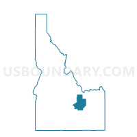
Outline

Summary
| Unique Area Identifier | 563897 |
| Name | Howe Voting District |
| County | Butte County |
| State | Idaho |
| Area (square miles) | 1,166.77 |
| Land Area (square miles) | 1,165.59 |
| Water Area (square miles) | 1.18 |
| % of Land Area | 99.90 |
| % of Water Area | 0.10 |
| Latitude of the Internal Point | 43.89928300 |
| Longtitude of the Internal Point | -112.94498960 |
Maps


Graphs
Select a template below for downloading or customizing gragh for Howe Voting District, Butte County, Idaho


Neighbors
Neighoring Voting District (by Name) Neighboring Voting District on the Map
- Voting District 033003, Clark County, ID
- Arco 2 Voting District, Butte County, ID
- Junction Voting District, Lemhi County, ID
- Leslie Voting District, Custer County, ID
- Monteview Voting District, Jefferson County, ID
- Moore Voting District, Butte County, ID
- Moreland 25 Voting District, Bingham County, ID
- Sunol Voting District, Custer County, ID
- Terreton Voting District, Jefferson County, ID
Top 10 Neighboring County Subdivision (by Population) Neighboring County Subdivision on the Map
- Atomic City CCD, Bingham County, ID (2,679)
- Challis CCD, Custer County, ID (2,614)
- Arco CCD, Butte County, ID (2,533)
- Mud Lake-Hamer CCD, Jefferson County, ID (2,338)
- Mackay CCD, Custer County, ID (1,421)
- West Clark CCD, Clark County, ID (904)
- Leadore CCD, Lemhi County, ID (619)
- Howe CCD, Butte County, ID (358)
Top 10 Neighboring Unified School District (by Population) Neighboring Unified School District on the Map
- Snake River School District 52, ID (7,898)
- Challis Joint School District 181, ID (3,104)
- Butte County Joint School District 111, ID (2,825)
- West Jefferson School District 253, ID (2,274)
- Mackay Joint School District 182, ID (1,487)
- Clark County School District 161, ID (982)
- South Lemhi School District 292, ID (625)
Top 10 Neighboring State Legislative District Lower Chamber (by Population) Neighboring State Legislative District Lower Chamber on the Map
Top 10 Neighboring State Legislative District Upper Chamber (by Population) Neighboring State Legislative District Upper Chamber on the Map
Top 10 Neighboring 111th Congressional District (by Population) Neighboring 111th Congressional District on the Map
Top 10 Neighboring Census Tract (by Population) Neighboring Census Tract on the Map
- Census Tract 9503, Bingham County, ID (5,914)
- Census Tract 9602, Custer County, ID (4,368)
- Census Tract 9601, Jefferson County, ID (3,989)
- Census Tract 9701, Butte County, ID (2,891)
- Census Tract 9703, Lemhi County, ID (2,465)
- Census Tract 9501, Clark County, ID (982)
Top 10 Neighboring 5-Digit ZIP Code Tabulation Area (by Population) Neighboring 5-Digit ZIP Code Tabulation Area on the Map
- 83221, ID (27,021)
- 83213, ID (1,644)
- 83251, ID (1,097)
- 83435, ID (653)
- 83244, ID (358)
- 83464, ID (345)
- 83253, ID (165)